
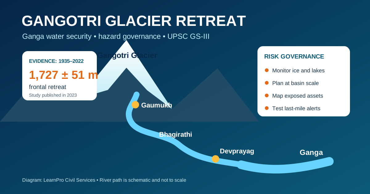
Gangotri Glacier retreat is a measurable change in the Garhwal Himalaya, not a claim that the Ganga will suddenly disappear. A 2023 study by scientists associated with the Wadia Institute of Himalayan Geology found that the glacier’s front receded by 1,727 ± 51 metres between 1935 and 2022. The issue matters for the UPSC examination because it connects the cryosphere with river flow, sediment, hydropower, pilgrimage, mountain livelihoods and disaster-risk governance.
UPSC relevance: GS Paper I—Himalayan geography; GS Paper III—climate change, water resources and disaster management; Essay—ecology and development. Focus keyword: Gangotri Glacier retreat.
Where is the Gangotri Glacier?
Gangotri is a large valley glacier in Uttarkashi district of Uttarakhand. Meltwater emerges near Gaumukh and feeds the Bhagirathi. At Devprayag, the Bhagirathi meets the Alaknanda and the river is thereafter called the Ganga. This geographical sequence is frequently relevant to Prelims.
What does the evidence show?
The most useful number is the long-period estimate, because glacier fronts can advance or retreat unevenly over shorter intervals. The 1935–2022 study used an old Geological Survey of India map, satellite images and repeat photography.
| Observation period | Estimated frontal change | What it means |
|---|---|---|
| 1935–2022 | 1,727 ± 51 m retreat; average 19.8 ± 0.2 m/year | Clear long-term recession of the glacier front |
| 2001–2006 | 7.0 ± 4.0 m/year | Retreat slowed during this short interval |
| 2006–2017 | 21.9 ± 1.9 m/year | Retreat accelerated again |
| 2017–2022 | 33.8 ± 6.7 m/year | Faster frontal retreat in the latest study interval |
Frontal retreat is not the same as total ice loss. A glacier can thin, slow, fragment or change its mass even when movement of the snout is modest. Sound assessment therefore combines field surveys, satellite observations, mass-balance measurements, snow data and river discharge.
Why is the glacier retreating?
- Rising temperature: warmer conditions lengthen the melt season and raise the snowline.
- Changing snowfall and rainfall: less accumulation as snow weakens the glacier’s annual ice budget; rain can increase rapid runoff.
- Black carbon and dust: dark particles deposited on snow lower reflectivity, so more solar energy is absorbed.
- Debris cover: a thin layer may enhance melting, while thick debris can insulate ice. Its impact is spatially uneven.
- Local topography: elevation, slope, aspect, avalanches and shading make each Himalayan glacier respond differently.
This is why one glacier should not be used as a proxy for the entire Himalaya. India needs glacier-specific observations within a basin-wide monitoring system.
Does Gangotri Glacier retreat threaten Ganga water security?
The answer changes by season, location and time horizon. More melting can initially increase summer flow and sediment. After a possible “peak water” stage, sustained ice loss can reduce the glacier’s buffering role in dry periods. Yet the main-stem Ganga is not supplied by glacier ice alone.
A Government of India reply, citing the National Institute of Hydrology, noted that rainfall and subsurface flows contribute more than 70% of Ganga flow at Haridwar. Glacier and snow contribution becomes proportionally smaller downstream as monsoon-fed tributaries join the system. Therefore:
- the upper Bhagirathi is more directly sensitive to snow and glacier change;
- downstream water security also depends on monsoon variability, groundwater, wetlands, pollution control and demand management;
- retreat can alter the timing of water availability even where annual flow does not collapse; and
- greater sediment loads can affect reservoirs, river habitats and infrastructure.
How does retreat affect disaster risk?
Retreat can expose unstable slopes and create or enlarge meltwater ponds. A glacial lake outburst flood (GLOF) occurs when water stored behind ice, moraine or bedrock is released suddenly. However, glacier retreat does not automatically produce a GLOF; lake size, dam condition, slope failure, avalanche exposure and downstream vulnerability must all be assessed.
The Central Water Commission’s 2025 monitoring programme covers 2,843 glacial lakes and water bodies in the Himalayan region and transboundary basins draining towards India. This is a screening and change-detection exercise—not a declaration that every monitored water body is dangerous.
| Risk layer | Required action |
|---|---|
| Source area | Satellite monitoring, field verification, lake-volume and moraine-stability assessment |
| Flow path | Model possible flood depth, velocity, sediment and arrival time |
| Exposed assets | Map settlements, roads, bridges, hydropower projects and pilgrimage routes |
| Last-mile readiness | Install redundant alerts, marked evacuation routes, drills and local response teams |
The NDMA guidelines recommend a complete risk-management cycle: inventory and classification, detailed assessment, monitoring and early warning, structural and non-structural measures, emergency action plans, community participation and periodic review. Read the related LearnPro explainer on early warning systems in the Himalayas.
What should India do?
- Build an open Himalayan cryosphere data system: combine ISRO/NRSC imagery, CWC lake monitoring, Wadia Institute field science, IMD weather data and State observations.
- Plan at river-basin scale: link glacier change with snow, springs, wetlands, groundwater, environmental flows and cumulative hydropower impacts.
- Use risk-informed infrastructure rules: apply hazard zonation, credible design floods and independent safety audits before approving mountain projects.
- Reduce short-lived climate pollutants: control diesel soot, open burning and dirty household or commercial fuels near sensitive valleys while pursuing long-term decarbonisation in India.
- Protect ecological buffers: conserve alpine vegetation, river corridors and sediment pathways instead of treating engineering works as the only solution.
- Put communities at the centre: alerts must reach porters, pilgrims, workers and remote villages in usable local-language formats.
Development in a young, tectonically active mountain system needs cumulative impact assessment. The issue is wider than ice: unstable slopes, extreme rainfall, road cutting and river constriction can compound one another. This should be read with the geography of the Siwalik Hills and the Himalayan foreland.
UPSC-ready analysis
Core argument: Gangotri Glacier retreat is both a climate indicator and a governance test. Its immediate significance is greatest in the upper Bhagirathi, while downstream Ganga security depends on the entire hydro-climatic system. Policy must avoid two errors—denying the risk and exaggerating it into an imminent disappearance of the river.
Mains conclusion: India should move from event-driven relief to continuous cryosphere observation, basin planning and locally tested early warning. Such an approach protects water, infrastructure, biodiversity and the cultural landscape of the Ganga together.
Sources used
- Wadia Institute of Himalayan Geology—Gangotri research record
- Journal of the Geological Society of India—frontal changes, 1935–2022
- Central Water Commission—glacial lake monitoring, September 2025
- NDMA Guidelines on Management of GLOFs
- Government of India reply on Gangotri Glacier and Ganga flow
Frequently asked questions
How much has Gangotri Glacier retreated?
A peer-reviewed 2023 study estimated that the glacier front retreated by 1,727 ± 51 metres between 1935 and 2022, averaging about 19.8 metres a year across the full period.
Is Gangotri the source of the Ganga?
Meltwater near Gaumukh feeds the Bhagirathi. The river is called the Ganga after the Bhagirathi joins the Alaknanda at Devprayag.
Will Gangotri Glacier retreat make the Ganga disappear?
No immediate disappearance follows from retreat. Rainfall, groundwater, tributaries and subsurface flow are major contributors, especially downstream. The serious concern is changing seasonality, upper-basin flow, sediment and long-term resilience.
What is the difference between glacier retreat and a GLOF?
Glacier retreat is a change in the position of the glacier front. A GLOF is a sudden release of water from a glacial lake. Retreat may help create lakes, but a flood requires additional failure conditions.
Which institutions monitor Himalayan glacier risks in India?
Relevant institutions include the Wadia Institute of Himalayan Geology, Geological Survey of India, ISRO/NRSC, Central Water Commission, Ministry of Earth Sciences, NDMA, IMD, State disaster-management authorities and research universities.





Sources and further reading
- Wadia Institute of Himalayan Geology—Gangotri research recordwihg.res.in
- Journal of the Geological Society of India—frontal changes, 1935–2022geosocindia.org
- Central Water Commission—glacial lake monitoring, September 2025cwc.gov.in
- NDMA Guidelines on Management of GLOFsndma.gov.in
- Government of India reply on Gangotri Glacier and Ganga flowpib.gov.in