
The Netarhat Plateau is one of the highest and most distinctive upland regions of Jharkhand. Located primarily in Latehar district in the western part of the state, it forms an important section of the Pat region of the Chotanagpur Plateau. Its broad summit generally lies around 1,000 metres above mean sea level, considerably higher than the Ranchi and Hazaribagh plateaus, while several local points rise above this general level.
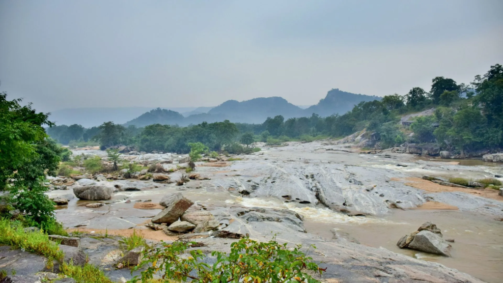
Netarhat is important not merely because of its elevation or tourism value. The plateau represents one of the best-preserved examples of Jharkhand’s upper-level plateau surface, with flat or gently undulating uplands, steep escarpments, deeply dissected margins, lateritic soils and extensive deciduous forests. Its elevation influences temperature, rainfall, drainage, vegetation, settlement and agriculture, making Netarhat an excellent example of how relief controls regional geography in Jharkhand.
Netarhat Plateau at a Glance
| Feature | Important Information |
|---|---|
| Location | Latehar district, western Jharkhand |
| Larger physiographic unit | Chotanagpur Plateau |
| Regional unit | Pat region / Western High Plateau |
| General elevation | Around 1,000 m above mean sea level |
| Relative position | Higher than Ranchi and Hazaribagh plateaus |
| Dominant rock foundation | Ancient crystalline rocks |
| Surface character | High, relatively level to undulating plateau |
| Margins | Steep and deeply dissected |
| Important nearby river system | North Koel and its tributary catchments |
| Important waterfall | Lodh Falls in the wider Netarhat-Latehar highland |
| Dominant soils | Lateritic and red-yellow soils |
| Vegetation | Tropical deciduous forest |
| Characteristic tree | Sal |
| Major economic activities | Agriculture, forestry, tourism |
| Climatic character | Cooler than surrounding lower plateaus |
Location of the Netarhat Plateau
The Netarhat Plateau lies in western Jharkhand, mainly within Latehar district. It forms part of the high plateau belt that extends through western sections of the Chotanagpur Plateau towards Gumla and Lohardaga.
Physiographically, Netarhat occupies a higher level than the Ranchi Plateau to the east. The plateau gradually breaks down through steep slopes, valleys and deeply dissected terrain towards the North Koel basin and adjoining lower surfaces.
Its broad geographical position can be understood as:
- North and north-east: descent towards the Latehar-Palamu region;
- East and south-east: transition towards Lohardaga and Gumla uplands;
- South and west: continuation into other western high plateau surfaces and forested tracts.
Netarhat therefore forms part of a wider belt of elevated Pat lands, rather than an isolated mountain.
Get all JPSC Notes https://learnpro.in/jpsc-notes/

Netarhat and the Pat Region
The term Pat is used in Jharkhand for high, relatively flat-topped plateau surfaces. These elevated surfaces are especially well developed in the western districts of Latehar, Lohardaga and Gumla.
Netarhat is one of the most famous examples of such a Pat. The plateau possesses a comparatively broad upper surface but is surrounded by steep slopes where streams have cut deeply into the margins.
The relationship can be represented as:
High flat plateau surface
↓
Steep escarpment
↓
Deeply dissected slopes
↓
Lower valleys and basins
This form gives Netarhat its characteristic tableland appearance.
Elevation of Netarhat Plateau
The general surface of the Netarhat Plateau lies at approximately 1,000 metres above mean sea level, although local elevations vary. Some surrounding uplands and ridges rise above the general plateau surface, while the valleys cut into its margins descend considerably below it.
The high elevation makes Netarhat one of the most prominent plateau landscapes of Jharkhand. However, it should be distinguished from Parasnath Hill, which rises to about 1,365 metres and is the highest point of the state.
Thus:
Highest prominent summit of Jharkhand → Parasnath
One of the highest extensive plateau surfaces → Netarhat and adjoining Pats
This distinction is important because a hill summit and a broad plateau surface represent different kinds of landforms.
Comparison of Plateau Elevations
| Physiographic Unit | Broad Elevation Pattern |
|---|---|
| Netarhat and major western Pats | Around 900–1,100 m |
| Ranchi Plateau | Around 600–700 m |
| Hazaribagh Plateau | Broadly around 600 m |
| Damodar Valley | Considerably lower structural basin |
| Parasnath summit | About 1,365 m |
The elevation difference between these surfaces is central to understanding Jharkhand’s stepped plateau relief.
Geological Foundation
The Netarhat Plateau is part of the ancient geological foundation of the Chotanagpur region. Much of the underlying terrain consists of old crystalline and metamorphic rocks, deeply weathered over an extremely long geological period.
The upper surface has experienced intense tropical weathering. Repeated chemical alteration and leaching produced:
- thick weathered profiles;
- lateritic material;
- iron-rich soils;
- aluminium-rich residual deposits in suitable locations.
These processes are closely related to the occurrence of bauxite across parts of the western high plateau region.
Formation of the High Plateau Surface
The present form of Netarhat cannot be explained as the product of a single uplift event. The landscape developed through a long sequence of denudation, tectonic movement and river incision.
A simplified geomorphological sequence is:
Ancient crystalline basement
↓
Long period of denudation
↓
Development of broad erosion surface
↓
Regional uplift
↓
River incision around margins
↓
Preservation of high plateau remnant
Netarhat can therefore be regarded as a surviving high-level erosion surface within the wider Chotanagpur Plateau.
Why Netarhat Has a Flat-Topped Appearance
The upper surface is relatively broad because it represents an old land surface that was extensively reduced by erosion before later uplift increased its height relative to surrounding areas.
After uplift, rivers began cutting down rapidly around the edges. The upper surface remained comparatively broad while the margins became steep and dissected.
This combination produced:
- broad summit area;
- steep slopes;
- narrow valleys;
- pronounced escarpments.
Such a landform is characteristic of many of Jharkhand’s western Pats.
Escarpments of Netarhat
The edges of the Netarhat Plateau contain prominent escarpments, where elevation falls sharply towards lower valleys. These slopes are among the most striking physical features of the region.
Escarpments influence:
- river gradients;
- waterfall formation;
- road construction;
- erosion;
- vegetation.
Roads approaching Netarhat must climb through steep terrain before reaching the more level upper plateau.
The sudden elevation changes are also responsible for some of the spectacular viewpoints associated with the region.
Drainage of the Netarhat Plateau
Netarhat forms an important headwater area. Numerous small streams originate on or around its elevated surface and flow towards lower river systems.
Much of the wider Latehar-Netarhat region drains towards the North Koel system, which ultimately joins the Son River. Other local streams descend through forested valleys before joining larger tributaries.
The drainage pattern is strongly controlled by:
- plateau slope;
- rock fractures;
- escarpments;
- valley incision.
For the wider river system of the state, see Drainage System of Jharkhand.
North Koel Connection
The North Koel River is the principal drainage artery of the wider Palamu-Latehar region. Many streams descending from the western highlands eventually contribute to the North Koel basin.
This creates an important relationship:
Netarhat highlands
↓
Small forest streams
↓
Tributaries
↓
North Koel
↓
Son River
↓
Ganga
Thus, rainfall falling on parts of the Netarhat region ultimately contributes to the Ganga drainage system.
Waterfalls of the Wider Netarhat Region
The combination of high elevation, steep escarpments and deeply cut streams has produced several waterfalls in the wider Latehar-Netarhat landscape.
The most important is Lodh Falls, also known as Burha Ghagh.
Lodh Falls is situated in the Latehar district highland region and is generally regarded as the highest waterfall of Jharkhand, with a total drop of roughly 140 metres.
Its existence is a direct consequence of the steep relief of the western Chotanagpur highlands.
Relief and River Erosion
Streams flowing over the relatively gentle plateau surface acquire a much steeper gradient when they reach the margins. Their erosional power therefore increases sharply.
This creates:
- narrow valleys;
- gorges;
- rapids;
- waterfalls.
Continued river erosion gradually cuts backward into the plateau margins, increasing the degree of dissection.
Over geological time, this process reduces the extent of the original plateau surface.
Climate of Netarhat
The most noticeable climatic characteristic of Netarhat is its relatively cooler temperature compared with lower parts of Jharkhand. This difference is primarily due to elevation.
At about 1,000 metres, the plateau experiences:
- milder summers;
- cooler nights;
- relatively cold winters;
- frequent mist and fog under suitable conditions.
The general relationship is:
Higher elevation → lower temperature
As a result, Netarhat has long been recognised for its pleasant summer climate.
Temperature
Summer temperatures on the plateau are generally more moderate than in low-elevation regions such as Palamu. Nights may remain comparatively cool even when the lower valleys experience intense heat.
Winter temperatures can fall sharply, particularly during clear nights when heat is rapidly lost from the elevated surface.
This altitudinal variation creates a noticeable climatic contrast over relatively short distances:
Netarhat high plateau → cooler
Latehar-Palamu lower valleys → warmer
Rainfall
Netarhat receives most of its rainfall from the south-west monsoon, mainly between June and September. Orographic effects created by the elevated plateau can influence local rainfall distribution.
Rainfall supports:
- dense forest vegetation;
- numerous seasonal streams;
- groundwater recharge;
- agriculture.
However, the steep terrain also generates substantial runoff, meaning that high rainfall does not automatically produce abundant dry-season water availability.
Monsoon Runoff
When heavy monsoon rain falls on steep plateau margins, water quickly enters streams and valleys.
The sequence is:
Heavy monsoon rainfall
↓
Steep slopes
↓
Rapid surface runoff
↓
High stream discharge
↓
Reduced dry-season surface water
This is one of the recurring geographical problems across the Chotanagpur Plateau.
Soils of the Netarhat Plateau
The soils of Netarhat are strongly influenced by high elevation, ancient rocks and prolonged tropical weathering. Red, yellow and lateritic soils occur across the region.
On old upper surfaces, intense leaching has produced:
- iron-rich soils;
- aluminium concentration;
- relatively acidic conditions;
- low natural fertility in many locations.
These soils tend to be less fertile than deeper valley soils unless improved through careful agricultural management.
Lateritic Soils
Laterisation is particularly important in the western high plateau. During intense chemical weathering, rainfall removes many soluble minerals while relatively insoluble iron and aluminium compounds remain.
The resulting lateritic soils are often:
- reddish or brownish;
- acidic;
- porous;
- nutrient-poor;
- rich in iron and aluminium compounds.
Where aluminium becomes strongly concentrated, economically useful bauxite may develop.
Bauxite and the Western High Plateau
The broader Netarhat-Lohardaga highland region is closely associated with Jharkhand’s bauxite geography. Important deposits occur on high lateritic plateau surfaces, particularly towards Lohardaga and adjoining Pat areas.
The relationship between relief and bauxite is significant:
Ancient high surface
↓
Long tropical weathering
↓
Strong leaching
↓
Removal of soluble materials
↓
Residual aluminium concentration
↓
Bauxite
This is one of the clearest examples in Jharkhand of a mineral resource created directly by surface weathering processes.
Natural Vegetation
Netarhat and the surrounding western plateau support extensive tropical deciduous forests. Forest cover is particularly strong along steep slopes and relatively inaccessible terrain.
Important species include:
- Sal
- mahua;
- kendu;
- bamboo;
- palash;
- kusum;
- mixed deciduous trees.
The forests create one of the most extensive continuous natural landscapes of western Jharkhand.
Sal Forests
Sal is the characteristic forest tree of much of the region. It thrives under the climatic and soil conditions of the Chotanagpur Plateau and forms large forest stands in suitable areas.
Sal forests provide:
- timber;
- fuelwood;
- leaves;
- wildlife habitat;
- soil protection;
- local livelihood resources.
The roots and forest litter also help reduce erosion on the plateau slopes.
Forest Cover and Relief
Forest distribution is closely related to terrain.
Plateau Summit
Contains a mixture of:
- forest;
- settlement;
- agriculture.
Steep Slopes
Generally retain denser forest because cultivation is difficult.
Valley Bottoms
More likely to be cleared for:
- agriculture;
- villages;
- roads.
This relationship demonstrates how land use follows micro-relief.
Wildlife
The extensive forests of the Latehar-Netarhat landscape support a variety of wildlife. Species associated with the broader region include:
- elephants;
- sloth bears;
- deer;
- wild boar;
- leopards;
- numerous birds and reptiles.
The forests also form an ecological connection with the wider Palamau Tiger Reserve-Betla landscape.
This makes the Netarhat region important not only as a high plateau but also as part of a larger wildlife habitat network.
Connection with Palamau Tiger Reserve
The forests surrounding Netarhat and Latehar lie close to one of Jharkhand’s most important protected landscapes, the Palamau Tiger Reserve.
The ecological significance of the wider region arises from:
- large forest blocks;
- low settlement density in rugged areas;
- river valleys;
- wildlife movement routes.
Maintaining connectivity between these forest tracts is important for large mammals that require extensive habitats.
Agriculture of the Netarhat Plateau
Agriculture is constrained by:
- high relief;
- shallow soils;
- lateritic conditions;
- forest cover;
- limited irrigation.
Cultivation is therefore concentrated on relatively level summit areas, gentle slopes and valleys.
Important crops include:
- paddy in suitable lowlands;
- maize;
- millets;
- pulses;
- vegetables.
The agricultural pattern varies according to local moisture availability.
Upland and Lowland Farming
Even on the high plateau, local differences in elevation determine land use.
Uplands
Characteristics:
- rapid drainage;
- thinner soils;
- lower moisture retention.
Suitable for relatively drought-tolerant crops.
Depressions and Valleys
Characteristics:
- deeper soils;
- greater moisture;
- sediment accumulation.
These areas support more intensive agriculture and paddy cultivation.
The same upland-lowland agricultural relationship found across Jharkhand therefore occurs even within the Netarhat Plateau.
Settlement Pattern
Settlement on Netarhat is relatively sparse compared with major urbanised regions such as Ranchi or the Damodar Valley.
This is because:
- terrain is rugged;
- forests occupy large areas;
- agricultural land is limited;
- transport access has historically been difficult.
Villages tend to occur on:
- relatively level uplands;
- gentle slopes;
- valley floors;
- locations near dependable water sources.
Steep escarpments remain lightly settled.
Tribal Geography
The western plateau and adjoining forest regions have long supported tribal communities whose livelihoods historically combined agriculture, forests and local natural resources.
The region lies within the broader cultural geography of communities such as the Oraon and several other Scheduled Tribe groups of western Jharkhand.
Forests historically provided:
- edible products;
- fuel;
- leaves;
- fibres;
- medicinal plants;
- grazing resources.
Agricultural fields and forests therefore functioned as complementary livelihood spaces.
For the wider background, see Tribes of Jharkhand.
Transport and Accessibility
The high elevation of Netarhat has historically made transportation more difficult than across gentler plateau regions.
Roads climbing to the plateau must negotiate:
- steep gradients;
- sharp bends;
- forested slopes;
- deeply incised valleys.
Once the upper surface is reached, however, the terrain becomes comparatively gentler.
This produces a characteristic contrast:
Difficult ascent → relatively level plateau top
Tourism Geography
Netarhat is one of Jharkhand’s best-known highland tourism regions. Its appeal is directly derived from physical geography rather than large built attractions.
Important tourism features include:
- high elevation;
- forest landscapes;
- escarpment viewpoints;
- cool climate;
- sunrise and sunset views;
- nearby waterfalls.
Netarhat is often referred to popularly as the “Queen of Chotanagpur”, reflecting its reputation as a scenic plateau destination.
Magnolia Point
Magnolia Point is one of the best-known viewpoints near Netarhat. It lies near the western edge of the plateau and overlooks deeply dissected lower terrain.
Its scenic value comes from:
- high elevation;
- wide horizon;
- steep plateau margin;
- extensive forest below.
The site is particularly associated with sunset views.
Geographically, it demonstrates the sharp contrast between the upper plateau surface and lower surrounding landscape.
Sunrise Point
The eastern side of the plateau contains viewpoints from which sunrise can be observed across the surrounding uplands.
These tourism locations are important because they visually reveal the plateau’s elevation above neighbouring regions.
The wide views are possible because:
- the plateau edge is high;
- adjoining terrain lies substantially lower;
- extensive forest limits dense construction.
Thus, tourism is directly based on the plateau’s geomorphology.
Netarhat School and Settlement Growth
Netarhat also developed importance as an educational centre with the establishment of Netarhat Residential School. Institutional development introduced a more organised settlement pattern on parts of the plateau.
However, unlike Ranchi, large-scale urbanisation has not occurred. Forest cover and relatively limited accessibility have helped preserve much of its rural and natural character.
This distinction makes Netarhat markedly different from heavily urbanised plateau centres.
Netarhat Plateau and Ranchi Plateau
| Feature | Netarhat Plateau | Ranchi Plateau |
|---|---|---|
| Location | Western Jharkhand | Central Jharkhand |
| General elevation | Around 1,000 m | Around 600–700 m |
| Physiographic level | Higher Pat surface | Intermediate plateau |
| Relief | High flat surface with steep escarpments | Broad undulating surface |
| Forests | More extensive | More fragmented by settlement |
| Urbanisation | Low | Very high around Ranchi |
| Major geographical identity | High plateau and forests | Water divide and waterfalls |
| Mineral association | Bauxite region nearby | Limited major mineral concentration |
The difference of several hundred metres in general elevation produces noticeable climatic and ecological contrasts.
Netarhat Plateau and Hazaribagh Plateau
| Feature | Netarhat | Hazaribagh |
|---|---|---|
| General elevation | Around 1,000 m | Broadly around 600 m |
| Plateau level | High | Intermediate |
| Forest cover | Extensive | More fragmented |
| Major geological association | Lateritic Pat surfaces | Crystalline plateau near coal basins |
| Major economic character | Forestry, agriculture, tourism | Agriculture, services, coal-belt proximity |
Netarhat represents the upper plateau level, while Hazaribagh forms part of the intermediate Chotanagpur surface.
Netarhat and Palamu
Netarhat is geographically connected with the Palamu-Latehar region but differs significantly in elevation.
Netarhat
- high plateau;
- cooler climate;
- denser forests;
- steep escarpments.
Palamu Basin
- lower elevation;
- hotter summer conditions;
- broader valleys;
- greater drought vulnerability.
The short geographical distance between the two demonstrates how strongly elevation can modify climate within Jharkhand.
Environmental Importance
The Netarhat Plateau performs several important ecological functions.
Its forests:
- protect headwater catchments;
- reduce erosion;
- regulate runoff;
- store carbon;
- support wildlife;
- provide forest products.
Because streams originate within the highland, degradation of forests can affect water availability far downstream.
This makes Netarhat an important watershed conservation region.
Soil Erosion
Steep plateau margins are highly susceptible to soil erosion when forest vegetation is removed.
During heavy monsoon rain, exposed soil may be carried downhill into streams and valleys.
The consequences include:
- loss of topsoil;
- gully formation;
- sedimentation of streams;
- declining agricultural productivity.
Maintaining vegetation on steep slopes is therefore particularly important.
Deforestation and Forest Fragmentation
Expansion of roads, settlements, agriculture and extraction of forest resources can fragment the natural landscape.
Fragmentation affects:
- wildlife movement;
- watershed protection;
- biodiversity;
- soil stability.
Because Netarhat lies within a broader forest belt, maintaining connections between separate forest blocks is especially important.
Mining Pressure
Bauxite-bearing highlands occur in the wider western Pat region. Mining of surface or near-surface bauxite can significantly modify plateau morphology because the mineral occurs close to the weathered upper surface.
Potential effects include:
- removal of vegetation;
- loss of topsoil;
- alteration of drainage;
- exposure of bare rock;
- increased erosion.
Post-mining reclamation is therefore particularly important in plateau environments.
Water Conservation
Despite substantial monsoon rainfall, dry-season water availability can become limited because much of the rainfall rapidly flows down steep slopes.
Useful measures include:
- check dams;
- contour trenches;
- farm ponds;
- spring protection;
- forest restoration;
- groundwater recharge structures.
Water management must therefore focus on retaining rainfall on the plateau for a longer period.
Economic Geography
The economy of Netarhat and adjoining highlands is less industrialised than the Damodar or Singhbhum regions.
Important activities include:
- agriculture;
- forest-based livelihoods;
- tourism;
- livestock;
- local trade.
The wider western Pat region also has important bauxite resources.
Thus, the economic geography is more closely linked with land, forests and plateau resources than with large-scale coal-based industry.
Why Large Industries Did Not Develop at Netarhat
Several geographical factors limited large-scale industrialisation:
- rugged access;
- high elevation;
- limited large urban markets;
- absence of major coal or iron-ore concentrations directly on the plateau;
- extensive forest cover;
- relatively sparse population.
As a result, the region retained a more rural and forest-dominated character.
Physical Geography and Tourism Economy
Tourism illustrates how natural physical features can themselves become economic resources.
Netarhat’s economy benefits from:
Elevation
↓
Cool climate
↓
Scenic plateau margins
↓
Forest landscape
↓
Tourism
This contrasts with the Damodar Valley, where economic development is based primarily on coal.
Core Data on Netarhat Plateau
| Indicator | Key Information |
|---|---|
| District | Latehar |
| Larger region | Chotanagpur Plateau |
| Physiographic unit | Western Pat Region |
| General elevation | Around 1,000 m |
| Relative plateau level | One of Jharkhand’s highest |
| Dominant geology | Ancient crystalline basement |
| Major weathering product | Laterite |
| Important mineral association | Bauxite in wider western Pats |
| Major drainage basin | North Koel |
| Important waterfall nearby | Lodh Falls |
| Approximate Lodh Falls drop | About 140 m |
| Natural vegetation | Tropical deciduous forest |
| Characteristic tree | Sal |
| Climate | Cooler upland tropical monsoon climate |
| Main economic activities | Agriculture, forestry, tourism |
| Major environmental concerns | Erosion, forest fragmentation, mining pressure |
Geographical Significance of Netarhat Plateau
The Netarhat Plateau is important because it preserves one of the clearest examples of the upper physiographic level of the Chotanagpur Plateau. Its broad high surface stands roughly 300–400 metres above much of the Ranchi Plateau and much farther above the lower valleys of western Jharkhand.
Its geography is built around a series of connected relationships:
High elevation → Cooler climate
High plateau → Steep margins → Waterfalls and deep valleys
Ancient weathered surface → Laterite → Bauxite
Rugged relief → Extensive forests
Forests + elevation → Tourism and wildlife habitat
Headwater location → Watershed importance
Netarhat therefore combines geological, geomorphological, climatic, ecological and economic significance. It is not simply a scenic hill station but one of the most important high plateau landscapes for understanding the physical geography of Jharkhand.
Frequently Asked Questions (FAQs)
1. Where is the Netarhat Plateau located?
The Netarhat Plateau is located mainly in Latehar district of western Jharkhand.
2. Which larger plateau does Netarhat belong to?
It forms part of the Chotanagpur Plateau.
3. Which physiographic region includes Netarhat?
Netarhat belongs to the western Pat or High Plateau region.
4. What is the approximate elevation of Netarhat Plateau?
Its general plateau surface lies around 1,000 metres above mean sea level, although local elevations vary.
5. Is Netarhat the highest point of Jharkhand?
No. The highest point is Parasnath Hill, at about 1,365 metres.
6. Why is Netarhat important despite not being the highest point?
It represents one of Jharkhand’s highest extensive plateau surfaces, rather than merely an isolated summit.
7. What is a Pat?
A Pat is a high, relatively flat-topped plateau surface characteristic of western Jharkhand.
8. Where are the Pats concentrated?
They occur mainly in Latehar, Lohardaga, Gumla and adjoining western areas.
9. Which rocks form the foundation of Netarhat?
The plateau is built largely on ancient crystalline rocks of the Chotanagpur region.
10. Why does Netarhat have a flat-topped appearance?
Its summit represents an old erosion surface that survived while surrounding areas were more deeply dissected by rivers.
11. Why are the plateau margins steep?
Streams cutting into the uplifted plateau created steep escarpments and deeply incised valleys.
12. Which major river system drains the wider Netarhat region?
Much of the wider region drains towards the North Koel River system.
13. Which famous waterfall lies in the wider Netarhat-Latehar highland?
Lodh Falls or Burha Ghagh is the most important.
14. What is the approximate height of Lodh Falls?
Its total drop is approximately 140 metres.
15. Which is generally regarded as the highest waterfall of Jharkhand?
Lodh Falls is generally regarded as Jharkhand’s highest waterfall.
16. Why is Netarhat cooler than Ranchi?
Netarhat lies several hundred metres higher than the Ranchi Plateau, resulting in lower average temperatures.
17. What type of climate does Netarhat have?
It has a tropical monsoon climate strongly modified by high elevation.
18. When does Netarhat receive most rainfall?
Most rainfall is received during the south-west monsoon from June to September.
19. What are the dominant soils of Netarhat?
Red, yellow and lateritic soils are important.
20. Why are lateritic soils common?
The old high plateau surface has undergone prolonged tropical weathering and intense leaching.
21. Why is bauxite associated with the western Pat region?
Prolonged weathering concentrated aluminium compounds in lateritic plateau surfaces, producing bauxite deposits.
22. Which type of vegetation dominates the plateau?
The natural vegetation is primarily tropical deciduous forest.
23. Which tree is especially important?
Sal is the characteristic forest tree.
24. Why are forests extensive around Netarhat?
High elevation, rugged terrain and steep slopes have restricted intensive agriculture and dense settlement.
25. What are the major crops?
Paddy is grown in suitable lowlands, while maize, millets, pulses and vegetables are also cultivated.
26. Why is agriculture relatively limited?
High relief, shallow lateritic soils, forest cover and limited irrigation constrain intensive farming.
27. Why is groundwater availability variable?
The underlying hard crystalline rocks store groundwater mainly in weathered and fractured zones.
28. Why is Netarhat important for watershed conservation?
Numerous streams originate in the highlands, and forests help regulate runoff and maintain downstream water flows.
29. What are the major environmental problems of the region?
Important concerns include soil erosion, forest fragmentation, mining pressure and seasonal water scarcity.
30. Why is Netarhat important in Jharkhand Geography?
Netarhat is one of the best examples of the high Pat landscape of western Jharkhand, showing the relationship between elevation, escarpments, drainage, lateritic weathering, forests, climate and human land use.





